Malta information hub
Geography of Malta
The Maltese archipelago in the central Mediterranean: the islands of Malta, Gozo and Comino, the coastline of bays, cliffs and caves, the regions, where people live and the natural environment.
Personalise this guide (stays on your device)
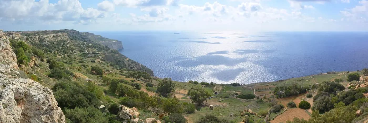
Malta is an archipelago in the central Mediterranean, roughly 90 km south of Sicily and 290 km from North Africa. The islands are low limestone plateaux tilted towards the north-east, so the south-west coast is lined with sea cliffs while the north-east has the harbours and bays where the towns grew.
Key figures
Population density
1,817per km²
2024
Eurostat — European Commission (data transmitted by NSO Malta) · verified 01 Oct 2026
Time zone
CET (UTC+1), CEST (UTC+2) in summer
EU summer-time rules
European Union (european-union.europa.eu) · verified 01 Oct 2026
Every figure shows the reference period and the publishing authority. Statistics are refreshed when the source publishes a new release; see the source register for document details.
| Indicator | Value | Period | Source |
|---|---|---|---|
| Land area | 316 km² | 2026 | Eurostat — European Commission · reg_area3 · verified 01 Oct 2026 |
| Time zone | CET (UTC+1), CEST (UTC+2) in summer | EU summer-time rules | European Union (european-union.europa.eu) · verified 01 Oct 2026 |
Interactive map of Malta
Localities, property listings, healthcare, education, transport, beaches and heritage sites as toggleable layers.
The islands
- Malta, the largest island, holds the capital Valletta, the airport and the great majority of the population.
- Gozo (Għawdex), to the north-west, is greener and more rural, with its own capital, Victoria.
- Comino (Kemmuna), between them, is a nature reserve with a handful of residents and the Blue Lagoon.
- Smaller islets include Cominotto, Filfla (a protected bird reserve off the south coast), St Paul's Islands and Manoel Island in Marsamxett Harbour.
Coastline, bays and beaches
The coastline alternates between sandy bays in the north (Għadira, Golden Bay, Għajn Tuffieħa, Paradise Bay), the two deep natural harbours on the east coast (the Grand Harbour and Marsamxett, either side of Valletta), rocky foreshores used for swimming around Sliema and the south-east, and sea cliffs in the west and south rising to about 250 m at Dingli. Sea caves include the Blue Grotto and the Inland Sea at Dwejra in Gozo. See the beach database.
Valleys and rural areas
Dry valleys (widien) cut the plateau and carry water only after rain; terraced fields, carob and olive trees, and garigue scrub cover the countryside. Buskett, near Rabat, is the only sizeable woodland. Gozo's landscape of flat-topped hills and valleys is the most rural part of the country.
Regions and where people live
Statistically Malta is divided into six districts: Southern Harbour, Northern Harbour, South Eastern, Western, Northern, and Gozo and Comino. The harbour districts around Valletta, Sliema, St Julian's and Birkirkara are the most densely populated; the Northern district (St Paul's Bay, Mellieħa, Mosta) has grown fastest. See Population and Cities and towns.
Natural environment
Natura 2000 sites protect cliffs, salt marshes (Għadira, Salina, Simar) and marine areas. Malta has no rivers or lakes; water comes from reverse-osmosis desalination and groundwater. Summers are dry and the islands are vulnerable to drought and heat.
Beaches
All beaches →Malta · Sandy
Għadira Bay (Mellieħa Bay)
Mellieħa
The longest sandy beach in Malta, shallow and gently shelving, with the Għadira nature reserve behind it.
Kiosks · Sunbeds and umbrellas (season) · Toilets · Lifeguards (season)
Malta · Sandy
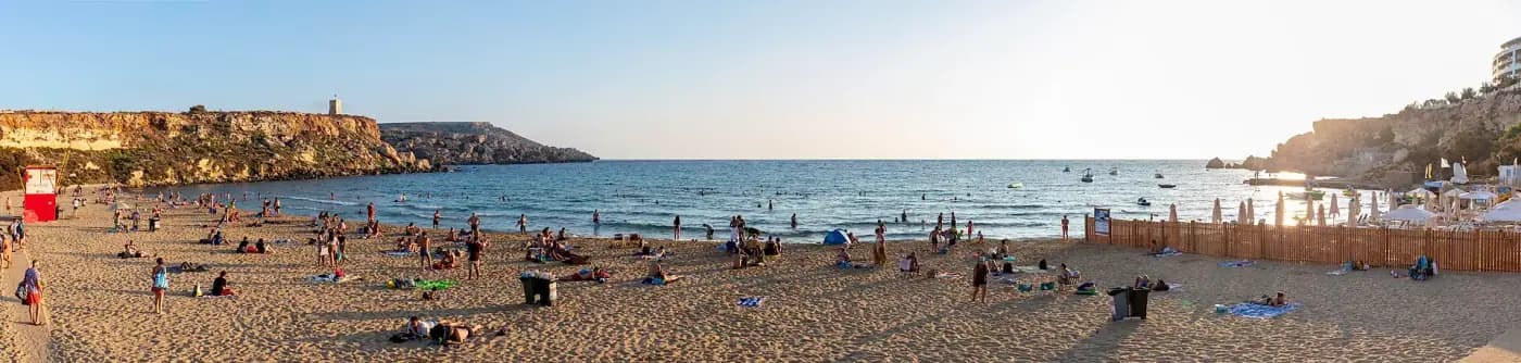
Golden Bay (Ir-Ramla tal-Mixquqa)
Mellieħa / Mġarr
A wide sandy bay on the north-west coast backed by a hotel and cliffs, with sunsets over the sea.
Kiosk · Sunbeds (season) · Toilets · Lifeguards (season)
Malta · Sandy
Għajn Tuffieħa Bay
Mġarr
A less developed sandy bay reached by a long flight of steps, next to Golden Bay, with red sand and clay slopes.
Seasonal kiosk · Limited toilets
Malta · Sandy
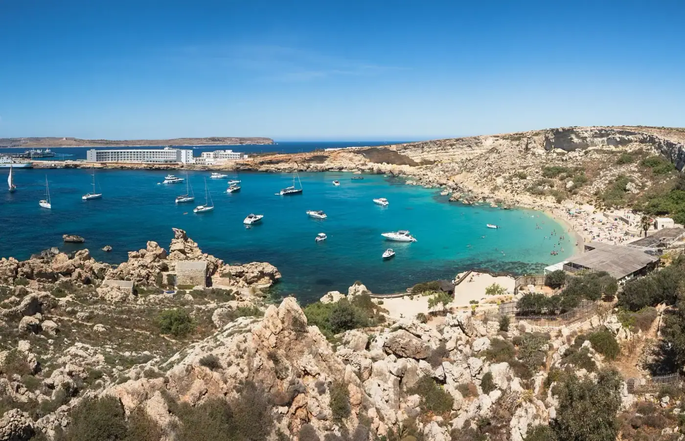
Paradise Bay
Mellieħa
A small sandy cove near Ċirkewwa with clear water and views to Comino.
Lido and restaurant (season)
Malta · Sandy
Armier Bay
Mellieħa
Two sandy coves at the northern tip of Malta facing Comino, with shallow water.
Kiosks · Sunbeds (season)
Malta · Sandy
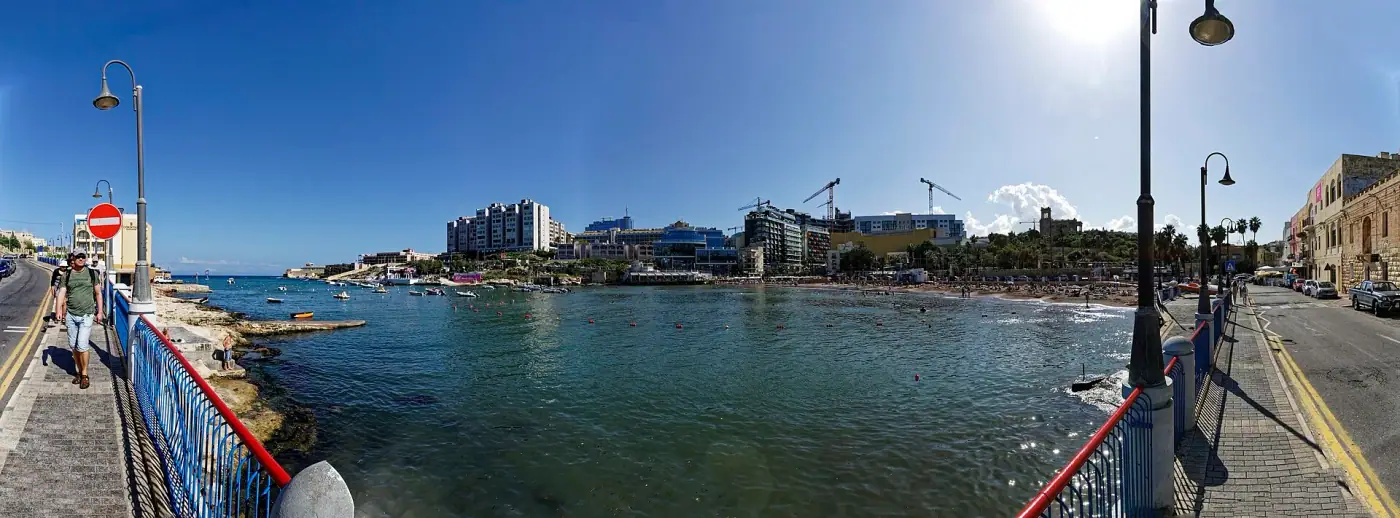
St George's Bay
St Julian's
A small man-made sandy beach in the heart of the St Julian's hotel district.
Toilets · Showers · Cafés nearby
Sources & Verification
Verified 1 October 2026 against the sources below- EU Institution
Eurostat — Society, education, health, digital and transport (isoc_ci_in_h, edat_lfse_03, educ_uoe_perp04, ilc_peps01n, isoc_sk_dskl_i21, road_eqs_carhab, hlth_rs_bds, reg_area3)
Eurostat — European Commission
Household internet access; tertiary attainment 30–34; pupil–teacher ratio; at-risk-of-poverty-or-social-exclusion; digital skills; passenger cars per 1,000; hospital beds; area
- Published
- 10 Sept 2026
- Effective
- —
- Last checked
- 01 Oct 2026
- Status
- Active
Reference: EUROSTAT-SOCIETYOfficial requirement - EU Institution
Eurostat — Population and demography (demo_pjan, demo_pjanind, demo_gind, demo_r_d3dens, migr_pop1ctz, demo_mlexpec, ilc_lvph01)
Eurostat — European Commission (data transmitted by NSO Malta)
Population on 1 January; population density; crude rates; citizenship; median age; life expectancy; household size
- Published
- 25 Sept 2026
- Effective
- —
- Last checked
- 01 Oct 2026
- Status
- Active
Reference: EUROSTAT-POPOfficial requirement - Tourism Authority
Malta Tourism Authority / Visit Malta
Malta Tourism Authority
Tourism licensing, accommodation regulations and the Visit Malta destination portal
- Published
- —
- Effective
- —
- Last checked
- 01 Oct 2026
- Status
- Active
Reference: MTAOfficial requirement
Related information
- PageMalta: Country Guide for Residents, Families and Investors
Verified, source-referenced information on living, working, studying, investing and owning property in Malta…
- PageHistory of Malta: Timeline from the Temples to EU Membership
A chronological history of Malta: prehistoric temples, Phoenicians and Romans, the Arab period, the Knights o…
- PageMaltese Culture: Identity, Traditions, Festas, Music, Art and Food
Maltese identity and traditions: language, village festas, carnival, fireworks, religious customs, music and…
- PageLanguages in Malta: Maltese, English and Everyday Use
The Maltese language, the role of English, Italian influence, the Maltese alphabet and pronunciation, languag…
- PagePopulation of Malta: Demographics, Migration and Localities
Verified population data for Malta: total population, density, growth, citizenship and foreign residents, age…
- PageClimate and Weather in Malta: Seasons, Temperatures, Rain and Sea
Malta's Mediterranean climate season by season: typical temperatures, rainfall, sunshine, sea temperature, wi…
Written by
Malta MPRP Guide Editorial Team
Research & editorial
The editorial team researches the Malta Permanent Residence Programme directly from the consolidated regulations (S.L. 217.26), the Legal Notices that amend them and the Residency Malta Agency's published material. Ever…
Reviewed by
Fact-check & source review
Responsible for reviewing published pages against the current text of S.L. 217.26 and the Agency's official pages, recording the verification date and flagging any page that needs an update after a legislative change. R…